Be Excellent To Each Other

And, you know, party on. Dude.

All times are UTC [ DST ]


Reply to topic  [ 89 posts ]  Go to page 1, 2  Next
Author Message
 Post subject: Hurricane Ike - Shitting Crikey!
PostPosted: Sun Aug 31, 2008 15:41 
User avatar
Excellent Member

Joined: 30th Mar, 2008
Posts: 8019
Location: Cardiff
Well for obvious reasons all eyes are now on the Gulf basin. Will Hurricane Gustav be dangerous - possibly fatal - for New Orleans? Mayor Nagin of New Orleans has been on the telly, warning everyone to get out of dodge. A wise move for the people of the city, but Nagin has actually overhyped the threat somewhat.

http://news.bbc.co.uk/1/hi/world/americas/7590426.stm

For one thing no hurricane has a footprint of "900 miles". That's practically the entire gulf in width! The hurricane also is unlikely to land as a catagory four or higher, so it will not be the 'storm of the century'. Computer tracks don't put the average path too close to New Orleans either, so its not as certain as Nagin is putting it. However, I can understand his hyperbole, you don't want people dithering. Fortunately it seems that people are getting out regardless of what he says, New Orleans is pretty deserted right now and the contra-flow system seems to be moving people out okay.

It seems that Gustav has weakened also, and is not starting the day at the same 'intensification starting point' as initially feared. Top level winds have dropped from 175mph to 125mph and the eyewall is looking a little ragged and bigger. Winds are estimated to drop later to 120mph and the pressure to be around 960mb. That's pretty good news, though it still means that Gustav will pack a punch on landfall, just not as big a one. Such momentary disorganisation of the storm's structure also means that it may have trouble sucking up enough fuel from the loop current as it should.

That's the good news. The bad is that Gustav still may experience a fast reintensification and get its act back together. It is shortly going to be passing over a warm water zone, and that's good eating for 'canes. There's still a chance that the hurricane will nethertheless weaken again and be back down to the 120mph mark, but worryingly it looks like there may be a better chance of further pressure drop and a sustained restrengthening of winds. The worst aspect of Gustav is that its moving a lot faster than Katrina. When a hurricane begins fringing land it falls apart quite rapidly if it is a slow mover. Katrina was a slow mover, and a last minute blast of cold air from Texas and Mexico weakened it substantially still and knocked it off course at the last minute, sparing the city. Yup, I said sparing. If that rare blast hadn't happened when it did, you would have been looking at 20,000+ dead in New Orleans and no city any more.

So Gustav is moving fast, and we're not guaranteed the fluky cold air surge. Current models put Gustav's track a way's west of New Orleans, enough to give it a rough time with minor levee failure probably. But there's a chance that it may track further east, and land just west of the city. That would be very bad news. A landfall just west of New Orleans is worse than one east, and even worse than landing plumb square on the city itself. Winds are always higher on the eastern side of a hurricane and the storm surge deadlier. Katrina landed on the east side of the city, causing damage from weaker west side winds.

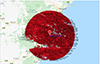
Also, everyone expected a track a lot, lot further away west from New Orleans. In the last few hours that track has shifted closer to the city, will it track further east again is the question?

Worst case scenario:

Gustav strengthens to cat 4 and comes ashore just west of New Orleans. Moving quickly it cannot decay over land. Wind speeds of 150mph+ knock the roofs of houses and a storm surge of around 20-30ft hits the city, overwhelming levees that are only there to protect against 12-15ft surges of Hurricane Betsy levels. The city is destroyed.

Fortunately it looks like the vast majority have evacuated, so the toll remains in the hundreds, maybe skirting a thousand or two.

Likely scenario: Gustav strengthens only a little and then weakens only a little. At 1 p.m Monday, the eye of Gustav will be in Timbalier Bay, just east of Port Fourchon, as a Category 4 hurricane with winds of 133 mph, fallign to a Category 1 further inland. (Google Earth it.) The landfall point is around sixty miles south of New Orleans, which puts the track at thirty-sixty miles east of the city.

http://www.nola.com says...

Quote:
That would place the offshore oil service center in the path of the most dangerous winds and up to 25 feet of surge topped by battering waves. The resort town of Grand Isle also is expected to be hammered by similar winds, surge and waves.

At 7 a.m., the center of Hurricane Gustav was 375 miles southeast of the mouth of the Mississippi River as it moves northwest at close to 16 mph. The storm will continue moving that quickly as it travels northwest across the Gulf until reducing speed on Monday as it crosses the coast.

Tropical storm force winds are expected to reach the southeast Louisiana coast before dawn on Monday, with hurricane force winds possible across the coast by mid-morning and spreading inland Monday afternoon and night.

There's a chance of isolated tornadoes as the first bands of the hurricane come ashore on the coast late Sunday night and farther inland on Monday and Tuesday.

The forecast now calls for Gustav to take a full day to reach a point just west of Opelousas, still as a Category 1 hurricane with 85 mph winds.

On that path, the bulk of Gustav will be moving across Houma, Morgan City, New Iberia, Lafayette and Breaux Bridge.


Let's hope it avoids having much effect on Lake Pontchartain, eh? I'll keep you updated on this one as more news comes in.

_________________
"Peter you've lost the NEWS!"

Bored? Why not look at some pretty pictures on my photography blog? Here: http://petetakespictures.com

Come & See My Flickery Pics Here: http://www.flickr.com/photos/nervouspete/


Last edited by Goddess Jasmine on Thu Sep 11, 2008 17:59, edited 2 times in total.
Requested by OP :0)


Top
 Profile  
 
 Post subject: Re: Hurricane Gustav
PostPosted: Sun Aug 31, 2008 16:02 
User avatar
Honey Boo Boo

Joined: 28th Mar, 2008
Posts: 12328
Location: Tronna, Canandada
Thanks, Pete! And now, over the Grim... with the traffic report.

GRIM...: Thanks, Meaty. Lots of FILTHY PLEBS were in the way of my Land Rover today. I had to ask Jeeves to pop up through the sunroof and shoot them with a rifle.


Top
 Profile  
 
 Post subject: Re: Hurricane Gustav
PostPosted: Sun Aug 31, 2008 18:20 
User avatar
Gogmagog

Joined: 30th Mar, 2008
Posts: 48650
Location: Cheshire
Surf is looking good for about a week in Cornwall at least.

_________________
Mr Chris wrote:
MaliA isn't just the best thing on the internet - he's the best thing ever.


Top
 Profile  
 
 Post subject: Re: Hurricane Gustav
PostPosted: Sun Aug 31, 2008 18:42 
User avatar
baron of techno

Joined: 30th Mar, 2008
Posts: 24136
Location: fife
Was anyone else following this, for Katrina?

http://interdictor.livejournal.com/2005/08/27/


Top
 Profile  
 
 Post subject: Re: Hurricane Gustav
PostPosted: Sun Aug 31, 2008 19:00 
User avatar
Gogmagog

Joined: 30th Mar, 2008
Posts: 48650
Location: Cheshire
kalmar wrote:
Was anyone else following this, for Katrina?

http://interdictor.livejournal.com/2005/08/27/


I was.

It was unexpectedly hilarious at times.

_________________
Mr Chris wrote:
MaliA isn't just the best thing on the internet - he's the best thing ever.


Top
 Profile  
 
 Post subject: Re: Hurricane Gustav
PostPosted: Sun Aug 31, 2008 19:09 
User avatar
Excellent Member

Joined: 30th Mar, 2008
Posts: 8019
Location: Cardiff
MetalAngel wrote:
Thanks, Pete! And now, over the Grim... with the traffic report.

GRIM...: Thanks, Meaty. Lots of FILTHY PLEBS were in the way of my Land Rover today. I had to ask Jeeves to pop up through the sunroof and shoot them with a rifle.


*chuckles*

_________________
"Peter you've lost the NEWS!"

Bored? Why not look at some pretty pictures on my photography blog? Here: http://petetakespictures.com

Come & See My Flickery Pics Here: http://www.flickr.com/photos/nervouspete/


Top
 Profile  
 
 Post subject: Re: Hurricane Gustav
PostPosted: Sun Aug 31, 2008 19:11 
User avatar
Sitting balls-back folder

Joined: 30th Mar, 2008
Posts: 10078
kalmar wrote:
Was anyone else following this, for Katrina?

http://interdictor.livejournal.com/2005/08/27/

Aye.


Top
 Profile  
 
 Post subject: Re: Hurricane Gustav
PostPosted: Sun Aug 31, 2008 19:15 
User avatar
Excellent Member

Joined: 30th Mar, 2008
Posts: 8019
Location: Cardiff
Hmm, things are looking a bit better now. IF Gustav does not have another severe pressure drop this one may fizzle out a bit. The excellent blog 'Weather Nerd' by Brendan Loy says:

Quote:
Bottom line, Hurricane Gustav is not an especially healthy storm at the moment, certainly nothing like the textbook major hurricane we saw south of Cuba yesterday. This is good for two reasons. One, Gustav has to get itself structurally re-organized before it can rapidly intensify, and if it takes long enough to do that, it may run out of warm Loop Current water before it can turn back into a monster. (As Eric Berger says, now is the time for rapid intensification to occur, if it’s going to happen at all.)

Two, even if Gustav does turn back into a monster a bit later today (say, late this afternoon), that’s better than doing so this morning, because it decreases the number of hours of Category 4+ winds blowing over the Gulf of Mexico and building up a massive storm surge. You’ll recall that Katrina’s surge was enormous because it spent so much time over the Gulf as a huge, intense hurricane. With each hour that passes without Gustav strengthening, the odds of a similar phenomenon occurring decrease. (Not that a borderline Cat. 2/3 hurricane doesn’t build up a significant surge, mind you. But it’s a far cry from a Cat. 4 or 5.)


Also, weather expert Dr Masters adds:

Quote:
NHC’s current storm surge forecast calls for a storm surge of 18-25 feet to the right of where the center of Gustav comes ashore. The latest computer generated storm surge map shows a bit lower maximum storm surge levels — about 15-18 feet on the east side of New Orleans. Storm surge levels of this magnitude are characteristic of a Category 4 hurricane. The levee system of New Orleans is designed to withstand a storm surge characteristic of a Category 3 storm. If the NHC storm surge forecast is correct, there will likely be multiple levee failures in the New Orleans levee system resulting in flooding of portions of the city.

However, the extent of Gustav’s current weakening was unexpected, and this could substantially reduce the storm surge. Given the current intensity forecasts, I believe there is a 60% chance that a lower storm surge of 12-15 feet, characteristic of a Category 3 hurricane, will affect the city. If the Army Corps of Engineers’ assertion that the levee system can withstand a Category 3 hurricane is correct, the levees will hold.


So it's looking a little rosier than it was before. Still not time to be complacent though, it could still be a bad 'un, it's just looking a fair bit less likely. Anyway, I'm off down to the Welsh Club to bop to Sweet Baboo's album launch. Only £2! Wonder what the situation will be like when I get back. Hmm...

_________________
"Peter you've lost the NEWS!"

Bored? Why not look at some pretty pictures on my photography blog? Here: http://petetakespictures.com

Come & See My Flickery Pics Here: http://www.flickr.com/photos/nervouspete/


Top
 Profile  
 
 Post subject: Re: Hurricane Gustav
PostPosted: Mon Sep 01, 2008 9:25 
User avatar
baron of techno

Joined: 30th Mar, 2008
Posts: 24136
Location: fife
I'm relying on this thread as my sole source of news on this topic, nervouspete, so keep the updates coming :)


Top
 Profile  
 
 Post subject: Re: Hurricane Gustav
PostPosted: Mon Sep 01, 2008 9:41 
User avatar
Excellent Member

Joined: 30th Mar, 2008
Posts: 8019
Location: Cardiff
Well, it's looking a little better, but still undecided.

Basically Gustav failed to reintensify much, leaving it at a category 2/3 with 115 - 120mph winds. It's still on more or less the same track, just WEST of New Orleans - the worst area for a hurricane to be in, but perhaps a smigeon too far from the city for true nastiness. The weather bloggers seem agreed that there's around a 44% chance of Hurricane winds in New Orleans, and a slightly lower chance of those being damaging. So in that sense not as bad as Katrina.

The bad news is that the hurricane has increased forward speed again and isn't showing signs of breaking up approaching land yet. Pressure has dropped further to 952mb as the last updates had it, which means its still holding together. The big question on everyone's lips is - will the levees hold?

This is tricky. Contrary to popular belief, Katrina only caused a 12 foot storm surge, and the levees were supposed to hold against 15-16ft. They did in the main, but several still failed catastrophically. The weakest levees in New Orleans are on the west side, the side facing the storm, and so far surge appears to be around 9ft. However, these are the early hours for the hurricane, and those waves could pick up.

So what's my thinking? I reckon New Orleans is going to come through this, if the engineers and city and government have done their job in the years since Katrina and restored them to their pre-disaster levels. The Corps of Engineers announced that they have, but their record along with all levels of government isn't exactly golden. If that storm surge picks up a few feet then New Orleans may see Katrina level flooding. As it stands I think they've dodged the bullet.

Make no mistake, it's still a nasty hurricane, especially for the US oil facilities directly under landfall, but its far, far from the killer storm-of-the-century Mayor Nagin warned about. (Though to be fair if the 'cane had intensified early Sunday, he would have been closer to the mark.)

Edited due to me boneheadedly accidently typing EAST instead of WEST.

_________________
"Peter you've lost the NEWS!"

Bored? Why not look at some pretty pictures on my photography blog? Here: http://petetakespictures.com

Come & See My Flickery Pics Here: http://www.flickr.com/photos/nervouspete/


Top
 Profile  
 
 Post subject: Re: Hurricane Gustav
PostPosted: Mon Sep 01, 2008 11:00 
User avatar
Excellent Member

Joined: 30th Mar, 2008
Posts: 8019
Location: Cardiff
Not much to update at the moment, seems the former colonials are sleeping and stuff at the moment. Tornado watch on in New Orleans. Landfall for the centre of the hurricane should be in about twelve hours over New Orleans. I think. I'm tired, I'm not sure.

We may still be looking at the predicted 9ft + surge. More data should be coming in early afternoon.

_________________
"Peter you've lost the NEWS!"

Bored? Why not look at some pretty pictures on my photography blog? Here: http://petetakespictures.com

Come & See My Flickery Pics Here: http://www.flickr.com/photos/nervouspete/


Top
 Profile  
 
 Post subject: Re: Hurricane Gustav
PostPosted: Mon Sep 01, 2008 11:21 
User avatar
Gogmagog

Joined: 30th Mar, 2008
Posts: 48650
Location: Cheshire
It's only a hurricane, and it's not like we gave a fuck when it went over Cuba, so why the fuck should I care about a bunch of swamp dwelling septics?

_________________
Mr Chris wrote:
MaliA isn't just the best thing on the internet - he's the best thing ever.


Top
 Profile  
 
 Post subject: Re: Hurricane Gustav
PostPosted: Mon Sep 01, 2008 11:25 
User avatar
baron of techno

Joined: 30th Mar, 2008
Posts: 24136
Location: fife
MaliA wrote:
It's only a hurricane, and it's not like we gave a fuck when it went over Cuba, so why the fuck should I care about a bunch of swamp dwelling septics?


Because it's like a disaster movie. And New Orleans kind of has it coming, what with being beneath sea level and whatnot. The added bonus is watching how well the richest and most arrogant country in the world deals with stuff like this when it isn't happening in the Hollywood hills. (Obviously, you hope the worst doesn't really happen because on previous evidence, the answer is "not very well")


Top
 Profile  
 
 Post subject: Re: Hurricane Gustav
PostPosted: Mon Sep 01, 2008 11:26 
User avatar
Gogmagog

Joined: 30th Mar, 2008
Posts: 48650
Location: Cheshire
kalmar wrote:
MaliA wrote:
It's only a hurricane, and it's not like we gave a fuck when it went over Cuba, so why the fuck should I care about a bunch of swamp dwelling septics?


Because it's like a disaster movie. And New Orleans kind of has it coming, what with being beneath sea level and whatnot. The added bonus is watching how well the richest and most arrogant country in the world deals with stuff like this when it isn't happening in the Hollywood hills.


Good oh. As you were then.

_________________
Mr Chris wrote:
MaliA isn't just the best thing on the internet - he's the best thing ever.


Top
 Profile  
 
 Post subject: Re: Hurricane Gustav
PostPosted: Mon Sep 01, 2008 11:47 
User avatar
Excellent Member

Joined: 30th Mar, 2008
Posts: 8019
Location: Cardiff
MaliA wrote:
kalmar wrote:
MaliA wrote:
It's only a hurricane, and it's not like we gave a fuck when it went over Cuba, so why the fuck should I care about a bunch of swamp dwelling septics?


Because it's like a disaster movie. And New Orleans kind of has it coming, what with being beneath sea level and whatnot. The added bonus is watching how well the richest and most arrogant country in the world deals with stuff like this when it isn't happening in the Hollywood hills.


Good oh. As you were then.


Also, because I am fascinated by weather systems. Despite lives being in danger I get a guilty thrill looking at the data myself and trying to guess what's going to happen. I also find it fascinating that hurricanes for the last couple of decades have generally only killed a few, thanks to warning systems and evacuation plans, and yet have this awe-inspiring power and energy that - with a certain horrible combination of factors - could destroy a city for ALWAY.

This disaster movie/weather nerd giddiness keeps blinding otherwise sensitive me to human plight. But that's the weak spot in my otherwise humane and vast-monkey-sphered existence.

But I am still hoping New Orleans catches a break. They should still demolish the city though and move somewhere else.

_________________
"Peter you've lost the NEWS!"

Bored? Why not look at some pretty pictures on my photography blog? Here: http://petetakespictures.com

Come & See My Flickery Pics Here: http://www.flickr.com/photos/nervouspete/


Top
 Profile  
 
 Post subject: Re: Hurricane Gustav
PostPosted: Mon Sep 01, 2008 12:39 
User avatar
Ticket to Ride World Champion

Joined: 18th Apr, 2008
Posts: 11843
Don't know what they are moaning about really, it looks quite nice:

http://www.bbc.co.uk/weather/5day.shtml?world=0274

Quote:
If the Army Corps of Engineers’ assertion that the levee system can withstand a Category 3 hurricane is correct, the levees will hold.

This is the important bit, I feel.

_________________
No, it was a giant robot castle!


Top
 Profile  
 
 Post subject: Re: Hurricane Gustav
PostPosted: Mon Sep 01, 2008 12:43 
User avatar
Excellent Member

Joined: 30th Mar, 2008
Posts: 8019
Location: Cardiff
Hurricane coming ashore now, expected to remain a category three for the next twelve hours.

This from Nola.com (the leading newspaper for New Orleans and a great online source) -

Quote:
At 5:45 a.m. strong east winds were driving water over the seawall along Lake Pontchartain in New Orleans. The water getting over the seawall where Canal Boulevard meets the lakefront was being easily contained by the lakefront levee. Floodgates at drainage canals remained open.


The Fresh Bilge blog has a happy outlook:

Quote:
Hurricane Gustav has appently ingested some more dry air overnight, and its convection has struggled. It is just reaching the coast. Top sustained winds are reportedly 115 mph. Central pressure 956 mb. The trajectory continues NW at 16, but the center looks a little west of expectations at this time. New Orleans will see intense rain-bands in the NE quadrant of the weakening storm during the day, but probably nothing serious enough to breach major levees. Radar here.


Though the path of the hurricane is identical to the New Orleans ravaging Betsy, it is around 40mph less intense and Orleans didn't have the levees then it has now. Things are looking better for Orleans, certainly.

http://www.nola.com goes on to say:

Quote:
The hurricane barrier guarding Algiers and West Jefferson is expected to fare well against Gustav's approaching surge, according to levee board and Jefferson Parish officials.

The West Bank was dealt a break last night when it became increasingly clear that the area wouldn't face the dire scenario as earlier predicted.

"It should be a manageable amount," said Tim Whitmer, top aide to Jefferson Parish President Aaron Broussard.

Nevertheless, Gustav is expected to flood Jean Lafitte and Grand Isle, which sit well outside the West Bank hurricane protection system. Estimates put water levels there at 5 to 8 feet above sea level at the highest, Whitmer said.

A threat also remains from heavy rainfall, but Whitmer said Jefferson pumping stations should be able to handle the 6 to 12 inches predicted for the next 18 hours.

Councilman Chris Roberts estimated that half of the West Bank was without electricity. He saw downed trees and street signs as he drove around Gretna and Harvey at about 6:30 a.m.

"We still haven't gotten the worst of the winds yet," he said.


I remember how it looked like New Orleans had dodged Katrina at first, but then it became increasingly apparent twelve hours after it had passed through that the levees were failing. Happily, from my memories of tracking that one the surge seems a lot less. It could still pick up dramatically as the winds and low pressure work on the lake and Mississippi more, but aside from flooding on the coast line and in the hurricane path, I reckon it's not going to be that bad.

_________________
"Peter you've lost the NEWS!"

Bored? Why not look at some pretty pictures on my photography blog? Here: http://petetakespictures.com

Come & See My Flickery Pics Here: http://www.flickr.com/photos/nervouspete/


Top
 Profile  
 
 Post subject: Re: Hurricane Gustav
PostPosted: Mon Sep 01, 2008 12:44 
User avatar
Excellent Member

Joined: 30th Mar, 2008
Posts: 8019
Location: Cardiff
Bobbyaro wrote:
Don't know what they are moaning about really, it looks quite nice:

http://www.bbc.co.uk/weather/5day.shtml?world=0274


Ha! Is that Michael Fish reporting again?

_________________
"Peter you've lost the NEWS!"

Bored? Why not look at some pretty pictures on my photography blog? Here: http://petetakespictures.com

Come & See My Flickery Pics Here: http://www.flickr.com/photos/nervouspete/


Top
 Profile  
 
 Post subject: Re: Hurricane Gustav
PostPosted: Mon Sep 01, 2008 12:48 
User avatar
Sleepyhead

Joined: 30th Mar, 2008
Posts: 27343
Location: Kidbrooke
I sincerely hope that this causes as little damage as possible... my bonus depends on it!

_________________
We are young despite the years
We are concern
We are hope, despite the times


Top
 Profile  
 
 Post subject: Re: Hurricane Gustav
PostPosted: Mon Sep 01, 2008 13:19 
User avatar
baron of techno

Joined: 30th Mar, 2008
Posts: 24136
Location: fife
Quote:
They should still demolish the city though and move somewhere else.


Yup! This is a good read, illustrates the sort of problems they're dealing with.

http://dir.salon.com/story/books/featur ... index.html


Top
 Profile  
 
 Post subject: Re: Hurricane Gustav
PostPosted: Mon Sep 01, 2008 13:38 
User avatar
I forgot about this - how vain

Joined: 30th Mar, 2008
Posts: 5979
I'm sure there are reasons it made sense at the time, but in a country that big with that much land why they decided to drain a swamp (thats beneath sea level) and live there is beyond me.

_________________
Curiosity wrote:
The Rev Owen wrote:
Is there a way to summon lave?

Faith schools, scientologists and 2-D platform games.


Top
 Profile  
 
 Post subject: Re: Hurricane Gustav
PostPosted: Mon Sep 01, 2008 13:43 
User avatar
Heavy Metal Tough Guy

Joined: 31st Mar, 2008
Posts: 6515
It's the port at the mouth of the Mississippi river, and was important for the trade of about half the US before railways kicked off. It's still a really major port, I think.


Top
 Profile  
 
 Post subject: Re: Hurricane Gustav
PostPosted: Mon Sep 01, 2008 13:48 
User avatar
I forgot about this - how vain

Joined: 30th Mar, 2008
Posts: 5979
D'oh. Of course.

Still I think it might be time to call it quits.

_________________
Curiosity wrote:
The Rev Owen wrote:
Is there a way to summon lave?

Faith schools, scientologists and 2-D platform games.


Top
 Profile  
 
 Post subject: Re: Hurricane Gustav
PostPosted: Mon Sep 01, 2008 13:49 
User avatar
Heavy Metal Tough Guy

Joined: 31st Mar, 2008
Posts: 6515
Probably. Or just buy a shed load of poles and stick everything there on 20ft stilts.


Top
 Profile  
 
 Post subject: Re: Hurricane Gustav
PostPosted: Mon Sep 01, 2008 13:59 
User avatar
I forgot about this - how vain

Joined: 30th Mar, 2008
Posts: 5979
Squirt wrote:
Probably. Or just buy a shed load of poles and stick everything there on 20ft stilts.


Which would have the added bonus of protecting you from zombie infestation.

_________________
Curiosity wrote:
The Rev Owen wrote:
Is there a way to summon lave?

Faith schools, scientologists and 2-D platform games.


Top
 Profile  
 
 Post subject: Re: Hurricane Gustav
PostPosted: Mon Sep 01, 2008 15:31 
User avatar
Excellent Member

Joined: 30th Mar, 2008
Posts: 8019
Location: Cardiff
Well, interesting things are happening to Gustav. Basically its losing part of its eyewall and beginning to tear apart. This always happens to some extent when hitting land, but not to this degree. The good news is that this means slightly less intense winds, with a peak of 115mph. We're looking at a category 2 in effect. The bad news is that the winds are spread over a wider radius, as they would be for a category 5, which means that New Orleans could come under some buffetting. However, the hurricane is also having difficulty with its northern vector, possibly due to an earlier than anticipated mass of dry air from the midwest. That's good news for New Orleans, as the hurricane is bundled west a little more sharply.

But what about those all important levees?

Dr Jeff Masters says...

Quote:
The main concern from Gustav is the storm surge. NHC is still predicting a 10-14 foot storm surge along the east side of New Orleans (Figure 2). This storm surge is characteristic of a Category 3 hurricane, providing a significant test of New Orleans' rebuilt levee system. Recent tide gauge readings from the east side of New Orleans show that a storm surge in excess of 7 feet has already occurred in Lake Borgne.


This is still within predicted tolerance limits of the levees at 15-16ft, but remember that it was only a 9-12 footer that did for New Orleans. So how is it holding up? Well contrary to the above http://www.nola.com says...

Quote:
Army Corps of Engineers chiefs say they anticipate no storm surge flooding due to Hurricane Gustav, which is turning out to be far less than what was previously forcast by the National Weather Service. But they do anticipate localized flooding due to heavy rainfall. That water will have to be handled by local drainage and pumping systems in each parish, they say.

"The dewatering of the internal city due to rainfall will be up to these non-federal pumping stations,'' said Brigadier Gen. Robert Van Antwerp, the corps' chief of engineers.

Numbers provided to Van Antwerp and corps District Commander Col. Al Lee early Monday indicated that non-federal systems throughout the region are reporting a variety of current pumping capacities.

Corps officials in the agency's operations center in New Orleans said there have been no reports of major problems within the federal hurricane flood reduction system.


So it's looking good at the moment. Sense the news networks masked chargrin at the lack of woe. Still, I imagine that coastline is getting a bit of a hammering right now. There's a small city of 30,000 under landfall, but if that's not totally evacuated then colour me surprised. May be the only crisis that comes out of this is oil disruption.

I'll be keeping my eye on the situation and keep you posted. ("Wahey." - BETEO.)

_________________
"Peter you've lost the NEWS!"

Bored? Why not look at some pretty pictures on my photography blog? Here: http://petetakespictures.com

Come & See My Flickery Pics Here: http://www.flickr.com/photos/nervouspete/


Top
 Profile  
 
 Post subject: Re: Hurricane Gustav
PostPosted: Mon Sep 01, 2008 16:13 
User avatar
Sitting balls-back folder

Joined: 30th Mar, 2008
Posts: 10078
I found myself wondering if there'll be some sort of announcement afterwards along the lines of "Oh no, there was some localised high wind that's blown down all that project/tenament/cheapy type housing that we desperately wish wasn't there so we could build new expensive stuff. If only everyone hadn't left the city. Nudge nudge. No, don't look at that column of bulldozers and overloaded quarry trucks driving away, look at this distraction over here!"

But then I'm sure that's just my unwarranted cynicism kicking in.


Top
 Profile  
 
 Post subject: Re: Hurricane Gustav
PostPosted: Mon Sep 01, 2008 16:38 
User avatar
Excellent Member

Joined: 30th Mar, 2008
Posts: 8019
Location: Cardiff
BikNorton wrote:
But then I'm sure that's just my unwarranted cynicism kicking in.


It is. 80% of New Orleans is project/tenament/cheapy type housing.

_________________
"Peter you've lost the NEWS!"

Bored? Why not look at some pretty pictures on my photography blog? Here: http://petetakespictures.com

Come & See My Flickery Pics Here: http://www.flickr.com/photos/nervouspete/


Top
 Profile  
 
 Post subject: Re: Hurricane Gustav
PostPosted: Mon Sep 01, 2008 16:41 
User avatar
Sleepyhead

Joined: 30th Mar, 2008
Posts: 27343
Location: Kidbrooke
*looks at pictures of levees with water going over them on BBC News*

Rut roh.

_________________
We are young despite the years
We are concern
We are hope, despite the times


Top
 Profile  
 
 Post subject: Re: Hurricane Gustav
PostPosted: Mon Sep 01, 2008 16:44 
User avatar
INFINITE POWAH

Joined: 1st Apr, 2008
Posts: 30498
Curiosity wrote:
*looks at pictures of levees with water going over them on BBC News*

Rut roh.

Where? Can't see those.

_________________
http://www.thehomeofawesome.com/
Eagles soar, but weasels don't get sucked into jet engines.


Top
 Profile  
 
 Post subject: Re: Hurricane Gustav
PostPosted: Mon Sep 01, 2008 16:48 
User avatar
Can you dig it?

Joined: 5th Apr, 2008
Posts: 4668
You seem to be good at this, Pete.

Is any bad weather likely to be heading Florida way soon? My sister goes there for her honeymoon next week. IT'D BETTER BE NICE.

_________________
rumours about the high quality of the butter reached Yerevan


Top
 Profile  
 
 Post subject: Re: Hurricane Gustav
PostPosted: Mon Sep 01, 2008 16:53 
User avatar
Excellent Member

Joined: 30th Mar, 2008
Posts: 8019
Location: Cardiff
Some more from Nola.

Image

Quote:
A small river of water is rushing down North Robertson Street toward Poland Avenue, coming from water splashing over the western wall of the Industrial Canal floodwall. Army Corps of Engineers officials said the spillage does not pose a major threat.

Water is overtopping for several hundred yards on the Upper Ninth Ward side of the Industrial Canal on both sides of the Claiborne Avenue bridge. Poland is parallel to the Industrial Canal.

Army Corps of Engineers said that the walls are designed to handle the overtopping without incident. The floodwalls have been strengthened since Katrina and are equipped with cement "spash pads" to prevent scouring from water coming over the walls, officials said. On the scene, the spillage was landing on the cement pads, which reduces its impact at the base of the wall.

"We're confident in the stability of that wall," which was fortified after Hurricane Katrina, said Karen Durham-Aguilera, director of Task Force Hope for the U.S. Army Corps of Engineers. Officials are out in force at the scene. The overflow areas appear to be greatest on the river side of Claiborne.

There is currently no water overtopping the eastern floodwall, which borders the Lower Ninth Ward. Much of that wall was replaced after Katrina and is taller than the wall on the western side.


John McCusker / The Times-Picayune
Water nears the top of the Lower 9th Ward Industrial Canal levee Monday morning. This is a view from Florida Ave. looking toward the river.
The L & N railroad bridge across the Industrial Canal also is in the down position causing a 3-foot backup of water in the canal, said engineer Bob Turner, executive director of the East Bank Regional Levee Authority.

That bridge is owned by the Port of New Orleans, but Mark Lambert, a spokesman for the state Department of Transportation and Development, said DOTD has offered to send teams to the area to help raise the bridge.

Turner has been in contact with the port and DOTD authorities about raising the bridge but the controls are underwater.

Chris Bonura, Port of New Orleans spokesman, said the bridge, built in 1919, is only able to handle winds up to 45 miles an hour, which means it cannot weather a hurricane in an upright position.

"Really, the public safety concern is that if it were raised during hurricane-force winds, the bridge could become unstable and fall on the floodwall or levee," Bonura said.

It is the Port's usual protocol to keep these old railroad bridges in the down position during a hurricane, Bonura said. The canal is designed with that factor in mind, he said.

St. Bernard Parish Sheriff Jack Stephens and Parish President Craig Taffaro were on the Claiborne Avenue bridge, checking the water levels. Water was lapping over the wall on the Upper Ninth Ward side, but had not yet overtopped the side closest to the Lower Ninth Ward.

"It's better than seeing cement collapsing but it's not good," Taffaro said.

"We're worried about the pressure building up on this wall," he said pointing at the corner of the floodwall nearest to the Claiborne Avenue Bridge.

On Poland Avenue about three blocks from the Claiborne Avenue bridge, 1½ feet of water was already pooled and the level was rising. A man, woman and two teenage boys were standing on a nearby porch.

The woman glanced up at the floodwall and started to weep. "Where's our levees?" said Bobbie, the woman who gave only her first name. "They said it wasn't supposed to be like this. I was here during Katrina. I'm not for this."

Then, two National Guard Humvees pulled up and started barking commands to the group to get in the truck.

"Let's go, let's go. Get the bags," said the man, as he climbed into the truck.

On the Claiborne Avenue Bridge, a New Orleans Police Department officer riding in an SUV was patrolling the area. Speaking over a bullhorn, he ordered all vehicles off the bridge.

"Y'all do realize that if that thing breaks, y'all are going to be here for a long time, and nobody's coming to get you," he said, as the crowd of media and onlookers generally ignored his admonition to get off the bridge.


Imagine that giving way, at night, when you're asleep in the shadow of it. That was what caused the majority of casualties in Katrina. Will it give way? No idea. I'm cautiously optimistic. It won't be scoured away as before, but the pressure on that thing must be incredible. Touch and go say I, but I think it'll hold.

_________________
"Peter you've lost the NEWS!"

Bored? Why not look at some pretty pictures on my photography blog? Here: http://petetakespictures.com

Come & See My Flickery Pics Here: http://www.flickr.com/photos/nervouspete/


Top
 Profile  
 
 Post subject: Re: Hurricane Gustav
PostPosted: Mon Sep 01, 2008 17:08 
User avatar
Excellent Member

Joined: 30th Mar, 2008
Posts: 8019
Location: Cardiff
Sir Taxalot wrote:
You seem to be good at this, Pete.

Is any bad weather likely to be heading Florida way soon? My sister goes there for her honeymoon next week. IT'D BETTER BE NICE.


Ahh, she may have trouble with Tropical Storm Hanna.

Quote:
If Hanna doesn’t hit South Florida, Ike might. Sheesh. And a new wave has just come off Africa — another strong one. It could also develop and commence the long march across the Atlantic.

Back to Hanna watching. Very intense convection continues around the center. A plane will be there soon. I think it will find a storm at the threshold of hurricane force. We should know more for the 2 PM intermediate advisory. I continue to find the southern model outlier plausible, with its South Florida landfall. The consensus still takes the storm toward Savannah, which has not suffered a direct hit in many years.


No one has any idea really when exactly it will hit. It's sort of loitering. But there seems to be a bit of a tropical storm and tropical depression parade going on at the moment, so things may be tricky. The only boon about Flordia and hurricanes is that they tend to tear over the narrow strip of land fairly quickly, not having enough time to cause much damage. Therefore airports are usually clear and infrastructure peachy, so I think she'll be okay. I'll keep you updated though!

_________________
"Peter you've lost the NEWS!"

Bored? Why not look at some pretty pictures on my photography blog? Here: http://petetakespictures.com

Come & See My Flickery Pics Here: http://www.flickr.com/photos/nervouspete/


Top
 Profile  
 
 Post subject: Re: Hurricane Gustav
PostPosted: Mon Sep 01, 2008 18:47 
User avatar
Can you dig it?

Joined: 5th Apr, 2008
Posts: 4668
Cheers Pete, it'll probably be OK, but nice to know what's going on.

_________________
rumours about the high quality of the butter reached Yerevan


Top
 Profile  
 
 Post subject: Re: Hurricane Gustav
PostPosted: Mon Sep 01, 2008 19:08 
User avatar
Excellent Member

Joined: 30th Mar, 2008
Posts: 8019
Location: Cardiff
New astoundo-pic from Nola.com.

Image

Which was a bit like how I felt walking home from work today. Ugh, it's very, very rainy in Cardiff today.

I think the odds on the wall breaking are very low now. The only danger is in the two barges that were left in the canal and have come loose in drifting over and impacting on the wall, which would rupture it. The odds on that are very low though. Looks like the wall is working. Amused to read comments on Nola complaining about the height of the wall. "Why didn't they build it bigger?! Army corps cutting corners again!" As if it's merely a matter of building a bigger wall. You add a foot to that wall you create another foot deep of lake pressure pounding away. It probably wouldn't hold. Worse, what is harmless overspill now (though in Katrina it was dangerous due to them not having concrete pads, leading to scouring) would be an increased strain.

There's a lot of anger on the web over the fact-free hyperbole blather of the major network reports. Seems they're treating it like a reality TV show. Also, there's a certain callousness in filming in the French Quarter and saying, "Eh, it's not so bad," when people's houses and livelihoods are getting torn apart along the South Louisianna coastline. There will be hundreds if not thousands of houses demolished along the coast from the 15ft coastal storm surge.

_________________
"Peter you've lost the NEWS!"

Bored? Why not look at some pretty pictures on my photography blog? Here: http://petetakespictures.com

Come & See My Flickery Pics Here: http://www.flickr.com/photos/nervouspete/


Top
 Profile  
 
 Post subject: Re: Hurricane Gustav
PostPosted: Tue Sep 02, 2008 0:30 
User avatar
Excellent Member

Joined: 30th Mar, 2008
Posts: 8019
Location: Cardiff
Just got back from a pretty terrible gig, late night update:

http://www.nola.com

Quote:
Plaquemines Parish levee overtopped, subdivision threatened
by Andrew Vanacore, The Times-Picayune
Monday September 01, 2008, 4:43 PM

The Caenarvon Mississippi River diversion in Plaquemines Parish will be opened to ease pressure on a levee that is being overtopped in Braithwaite, near the St. Bernard Parish line. The Corps of Engineers has approved running the diversion pumps in reverse to help drain the water and take pressure off the levee that runs along the Clearwater Canal.

Plaquemines Parish workers have been furiously working on the levee since mid-afternoon. Floodwaters spilling over the top of the levee threaten the Braithwaite Park subdivision. The levee has not breached, but authorities are not hopeful.

"We don't think our efforts are going to be successful so we need to get everyone out now,'' Parish President Billy Nungesser said.

Officials said opening the diversion would allow some of the floodwater to be diverted into the Mississippi River, which is lower.

Meanwhile, St. Bernard Parish is sending firefighters, deputies and other workers to the area to help with the efforts. Orleans Parish is also sending firefiighters and the corps is sending a truck with huge sandbags. The canal is on the east bank of the parish. The subdivision is off Louisiana 39. The 8-foot-tall levee is a parish levee that is not part of the federal levee protection system, officials said.

Officials said the same levee is also being overtopped further south at Scarsdale.


Could be bad, still not Katrina scale though if it does break. If the wall or levee does give way then that's some intensive flooding, however. Overall it looks like New Orleans has dodged the bullet. Here's Brendan Loy's WeatherNerd blog:

Quote:
As expected, New Orleans appears to have avoided any major flooding. The water level has subsided on the Industrial Canal after the dramatic live video of overtopping earlier this afternoon. Moreover, a quick perusal of the Times-Picayune’s New Orleans Hurricane Center reveals one report after another of no major flooding: in the West Bank, in St. Bernard, in East Jefferson, in the Upper 9th Ward, in Slidell, and so on. So, good news all around. New Orleans truly did dodge a bullet this time.


Meanwhile the Industrial Canal - one of the critical points that breached during Katrina - is still holding.

Image

The Industrial Canal

It is now the backwash of the storm that is causing the surge. However, in case you're all going, "Pfah! It was just an overhyped threat due to the disaster Katrina was, there wasn't anything to be afraid of!" Well, read this chunky fucker by weather expert and quality blogger Dr Jeff Masters:

Quote:
We got very lucky with Gustav — it could have been another Katrina. Both Gustav and Katrina had similar diameters (not radii) of tropical storm force winds at landfall: 440 miles. However, Katrina affected the coast with a region of hurricane force winds 170 miles across — 45% larger than the 115 miles of coast affected by Gustav. Both storms passed over some very high heat content waters in the Gulf of Mexico: Katrina, over a Loop Current eddy, and Gustav, over the Loop Current itself. Why didn’t Gustav explode into a Cat 5 monster storm when it crossed the Loop Current yesterday? Well, when a hurricane has a well-formed circular eyewall that is aligned vertically from the surface to the upper atmosphere, it acts as a very efficient heat engine that can take heat out of the ocean and convert it to the kinetic energy of its winds. When Katrina hit its Loop Current eddy, the hurricane was under low wind shear and had an ideal structure like this for taking advantage of the heat energy offered to it. Gustav, on the other hand, had just crossed Cuba when it hit the Loop Current. Gustav was under about 15 knots of wind shear, which it had been able to hold off, thanks to its tight, well-formed eyewall. However, passage over Cuba disrupted the eyewall structure just enough to allow the upper-level winds shearing it to penetrate into the heart of the hurricane. These winds ripped up the eyewall and tilted it, so that the surface eye was no longer underneath the upper-atmosphere eye. A tilted eyewall structure is not able to act as an efficient heat engine until it can get itself lined up more vertically, so Gustav was unable to take advantage of the warm Loop Current waters it was traversing. It’s like when your car engine is not firing on all cylinders and you hit the gas pedal — nothing happens. Once Gustav finally did align its eyewall vertically and armored itself against the effects of the wind shear, it had passed beyond the Loop Current and was over cooler waters of much lower heat content. Thus, Gustav was not able to intensify much before landfall. The computer models that predicted a Category 4 hurricane at landfall could easily have been correct, had the shear been a few knots less when Gustav crossed Cuba.


So things are looking better in New Orleans? Well, this French Quarter pic shows wind has died down. But Storm Surge is affected by pressure not wind. Still, pleasant times in the historic heart of New Orleans:

Image

Incidently, Hanna is now a hurricane. Sorry Sir Taxalot. :(

_________________
"Peter you've lost the NEWS!"

Bored? Why not look at some pretty pictures on my photography blog? Here: http://petetakespictures.com

Come & See My Flickery Pics Here: http://www.flickr.com/photos/nervouspete/


Top
 Profile  
 
 Post subject: Re: Hurricane Gustav
PostPosted: Tue Sep 02, 2008 0:34 
User avatar
Excellent Member

Joined: 30th Mar, 2008
Posts: 8019
Location: Cardiff
Update!

The local paper and quality source Times-Picayune says:

Quote:
Plaquemines Parish officials are trying to open the Caenarvon Mississippi River diversion to ease pressure on a levee that is being overtopped in Braithwaite. Since power is out in the area, however, they are trying to open the diversion gates manually.

Plaquemines Parish workers have been furiously working on the levee along the Clearwater Canal since mid-afternoon. Floodwaters spilling over the top of the levee threaten the Braithwaite Park subdivision.

The levee has not breached, but authorities are not hopeful. “We don’t think our efforts are going to be successful so we need to get everyone out now,” Parish President Billy Nungesser said.


So what's the Plaquemines area? Well, it's a sector of around 400 homes and small businesses. Distressing but not catastrophic. Unfortunately, that's not all the news, Brendan Loy's excellent WeatherNerd blog (which got a Time magazine feature and of which I followed in the run-up to Katrina, being the most erudite and compelling - and all that and being run by a fellow ginger four years my junior) has this unsubstantiated report:

Quote:
UPDATE: Now WWL-TV is reporting that parts of Montegut levee in the Terrebonne area have overtopped. Also, separately, there’s another endangered levee in Lower Lafitte area. [UPDATE, 7:20 PM: Governor Jindal says there is an unconfirmed report that the Lower Lafitte levee — in the Houma area, closer to the landfall spot — has breached.]


That's bad news. How bad we'll find out soon. Or in the morning, when we wake up.

Meanwhile some great images here from the Wall Street Journal:

http://online.wsj.com/article/SB122027884503687405.html

Right, I'm off to bed. Guess it'll all be decided by the time I wake up.

_________________
"Peter you've lost the NEWS!"

Bored? Why not look at some pretty pictures on my photography blog? Here: http://petetakespictures.com

Come & See My Flickery Pics Here: http://www.flickr.com/photos/nervouspete/


Top
 Profile  
 
 Post subject: Re: Hurricane Gustav
PostPosted: Tue Sep 02, 2008 9:05 
User avatar
baron of techno

Joined: 30th Mar, 2008
Posts: 24136
Location: fife
The radio says they're starting to bus people back in so it can't be too bad.
2 million people!


Top
 Profile  
 
 Post subject: Re: Hurricane Gustav
PostPosted: Tue Sep 02, 2008 9:28 
SupaMod
User avatar
Commander-in-Cheese

Joined: 30th Mar, 2008
Posts: 49232
Of course, this means that next time a hurricane hits the Gulf Coast, everyone will say "Pfah, they said the last one was going to be the disaster of the century, and it was just a bit of rain and wind! Fucked if I'm leaving this time". And they'll all drown.

_________________
GoddessJasmine wrote:
Drunk, pulled Craster's pork, waiting for brdyime story,reading nuts. Xz


Top
 Profile  
 
 Post subject: Re: Hurricane Season!
PostPosted: Tue Sep 02, 2008 9:54 
User avatar
Excellent Member

Joined: 30th Mar, 2008
Posts: 8019
Location: Cardiff
Yup, people only seem to remember the last one.

Well, updates. Nagin says that the earliest people can start coming back is Wednesday, which has ruffled a lot of feathers. This is actually on recommendation by the governor. There's a lot of power out over the city and trees, branches, lines and signs all over the place. People still want to start returning home though, and there seems to be a fair bit of fury over the fact that they aren't allowed when the news reports show a lack of damage. My earlier post about a potential levee failure thankfully wasn't substantiated. There's no mention of it this morning.

It will be interesting to see how the coast fared. Mayhap there's a lot of damage there, though I can't imagine anyone stuck around to get killed.

So, my conclusions?

1: The evacuation went smoothly this time and was vastly improved. It was sounded sufficiently early, last time it was left almost too late.

2: The Hurricane itself came ashore as moderate category 2 instead of the category 4. There's some flack being directed at Nagin's hyperbole speech, but that really is unfair. Intensity forecasts are impossible to be exact about, and it did look like the warm loop current was going to intensify it far more than it did. So why is this? Well, Cuba took a chunk out of the hurricane breaking it up a little. Normally it would have reformed pretty fast, but a blast of cool dry air coming in from Mexico updrafted into the system and tore a hole in the eyewall. This tilted the hurricane and prevented it from effectively scooping up the energy it usually would. So bravo for the Mexico winds. Once again, a fluky last minute blast of air has spared New Orleans, as it did with Katrina. (No, really. Katrina would have wiped out New Orleans last time as a strong category 3 were it not for that wobble.)

3: The weather blogs once again usurped the mainstream media. Network coverage was laughable, and seeing wet reporters grimacing and leaning into gale force winds is getting pretty feeble. The blogs collate data from people on the ground, bundle the best predictions, have links to better, more responsive local news sites and add their own theories on top. Bravo blogs.

4: Don't forget the gulf coast. While everyone is having a handjob over the sparing of New Orleans, the primary oil facility of the US gulf has suffered a direct hit and no one knows how damaged it is. Likewise for the small city of Houma, home to 30,000, and the homes of two hundred thousand and more in the path of Gustav. This wasn't a squib.

5: New Orleans has proved it can survive a category 2. Lets just hope it doesn't get people to thinking that it means the levees can survive bigger hits. You can't protect against a category 4, and that's why you were evacuated. Also, will you idiots stop thinking that stopping storm surge is as simple as adding another eight or so feet to a levee. If they could do that, they would, but the pressure would rip it away. You live in the most retarded place for a city on Earth. You can't magically fix what is a deathtrap.

6: Hurricane season is gearing up with in the last two days a big parade of new exciting hurricanes, tropical storms and tropical depressions assembling. Hurricane Hanna is currently stalling at 4mph but could prove a threat to Florida still, or as some are arguing New York. (It has happened before, believe it or not, to devestating effect.) Tropical storm Ike looks likely to develop and there's Tropical depression Josephine that looks set to become a storm too. There's also a couple of tropical waves forming that could add another two to the mix. Remember though that only 10-20% of tropical storms eventually hit the US, so its early days indeed.

A report later on Gustav's damage and a little on political shennanigans. Also more to come over the season which ends November. The Hurricane commentary by nervouspete CANNOT BE STOPPED.

_________________
"Peter you've lost the NEWS!"

Bored? Why not look at some pretty pictures on my photography blog? Here: http://petetakespictures.com

Come & See My Flickery Pics Here: http://www.flickr.com/photos/nervouspete/


Top
 Profile  
 
 Post subject: Re: Hurricane Gustav
PostPosted: Tue Sep 02, 2008 10:01 
User avatar
baron of techno

Joined: 30th Mar, 2008
Posts: 24136
Location: fife
This is very excellent reportage nervouspete. And it spares the likes of me trawling through broken local newspaper websites and blogs with depressing republican attack ads on them.
Thank you.


Top
 Profile  
 
 Post subject: Re: Hurricane Gustav
PostPosted: Tue Sep 02, 2008 10:20 
User avatar
Excellent Member

Joined: 30th Mar, 2008
Posts: 8019
Location: Cardiff
Aw, thanks Kalmar!

Craster wrote:
Of course, this means that next time a hurricane hits the Gulf Coast, everyone will say "Pfah, they said the last one was going to be the disaster of the century, and it was just a bit of rain and wind! Fucked if I'm leaving this time". And they'll all drown.


DA-NA!

Looking at the comments in the Nola news article on the pretty-prompt-in-my-opinion-Wednesday-home-again plan Craster may be bang on the money for some Oreleo's at least:

#comments">http://www.nola.com/hurricane/index.ssf ... l#comments

Quote:
Posted by leveeliar on 09/01/08 at 9:28PM
Its so easy for these clowns to say to stay away a few days longer. I live uptown, I have power, did not flood. Nagin doesn't have that problem. He can return to Dallas anytime he wants. Give these Bozos a little authority and they act like the MAN. I will never evacuate again, its too much of a hassel.


If it were a category four you wouldn't have a house, let alone power. If the levee system fully breaks - which it didn't in Katrina - there is no uptown, EVERYTHING is under water. Clod.

Quote:
Posted by aknight on 09/01/08 at 10:57PM
Since when did this "tier" system of re-entry start. Ray Nagin making it up as he goes along? The evacutation may have been necessary for psychological reasons more than anything but whatever: it is DONE. Forget about it. Now, re-entry. I think 1 day is enough: they will know whether the levees are going to hold and people have a right to their homes and lives. We are in Dallas, will spend Tuesday here to give officials a chance to re-group, and we will return to Orleans Parish on Wednesday. This is getting to be a little ridiculous: scare the hell out of everybody with a "storm a the century" which does minimal damage to NOLA and then keep everybody out for an extra day. If the other parishes in the area (with more people post-Katrina) need only one day why does Orleans need 2? See you in NOLA on Wednesday.


No you clot, at the time evacuation sounded it could easily have been a Category Four. You don't wait to evacuate a few hours before hand to be sure if you need to or not, you need a day at least, nor is evacuation about certainties. There was a 40% chance of being a four, more likely it was going to be a two or borderline three. Sure Nagin and everyone should have played Russian roulette!

Quote:
The phrase that sticks most in my mind when New Orleans has a "Nagin Moment" is: "If you don't evacuate, you'll be on your own." It is now blindingly obvious that we are indeed better off "on our own". I stayed for Katrina, evacuated for Gustav. Staying was FAR LESS of a hassle.


B'oh!

Quote:
Posted by godnot4u on 09/01/08 at 11:30PM
This was not the mother of all storms and it was never aimed at NOLA. And Kyros, your statement is a bit like "Let them eat cake." Have you ever looked around your city and noticed that MOST people are NOT salaried, you stupid, self-centered twit.

This is a bad idea, NOLA. The day we left, I knew it was a dumb thing to be doing, but I did as my Mayor and governor told me to do. However, I will not ever do it again.


Ack!

To be fair, there are wise voices on that comments thread. But worryingly too many dullards. People don't seem to realise that the reason they can't go home yet is not New Orleans, but the road links the storm went over between where they are now and New Orleans. Torrential rain, downed power lines, trees - if Nagin said "come home tomorrow" everyone would pile back now and there would be a mammoth traffic snarl lasting a good day. And more criticism. Nagin is indeed one of the worst mayors in America, but he has this on good advice. He should probably release a statement though explaining the wisdom behind the decision.

_________________
"Peter you've lost the NEWS!"

Bored? Why not look at some pretty pictures on my photography blog? Here: http://petetakespictures.com

Come & See My Flickery Pics Here: http://www.flickr.com/photos/nervouspete/


Top
 Profile  
 
 Post subject: Re: Hurricane Gustav
PostPosted: Tue Sep 02, 2008 10:43 
User avatar
Heavy Metal Tough Guy

Joined: 31st Mar, 2008
Posts: 6515
Out of interest nervouspete, how often can we expect a cat 4/5 to hit bang on the nose? Is it a once in a million years thing, or once in a century, or more often? It seems like New Orleans is screwed sooner or later it's just a matter of when and how badly,


Top
 Profile  
 
 Post subject: Re: Hurricane Gustav
PostPosted: Tue Sep 02, 2008 10:48 
User avatar
baron of techno

Joined: 30th Mar, 2008
Posts: 24136
Location: fife
I think I read somewhere that the levees are theoretically up to a "once in 100 years" flood level. That, from what I learned on my recent visit to the Netherlands, is rather crappy.


Top
 Profile  
 
 Post subject: Re: Hurricane Gustav
PostPosted: Tue Sep 02, 2008 12:03 
User avatar
Excellent Member

Joined: 30th Mar, 2008
Posts: 8019
Location: Cardiff
The odds on a category four or higher hurricane making landfall in the US are quite low, but not low enough. There have only been twelve category fives since 1928 to strike the Americas, unusually in 2007 there were for the first time two in one season - Dean and Felix hitting the Yucatan Peninsula and Nicaragua respectively. There have only been three in recorded history (post 1920's) to hit the United States, 'Labor Day' hitting the Florida Keys in 1935 killing 400-600, Camille hitting Mississippi and Alabama in 1969 killing 259 and Andrew hitting Florida in 1992 killing only 26 but being the costliest until Katrina.

Category four landfalls are number around twelve US landfalls in the same time period.

Category 2 & 3 are more common, with usually one landfall a year in the US, sometimes two. Category 1's aren't much more powerful than a tropical storm and don't garner much mention.

So the odds of a cat four and higher hitting bang on New Orleans are pretty low admittedly, I'd say you could expect one every 80 - 100 years. Which hasn't happened yet. A category four coming within 110 miles of New Orleans could overwhelm the city however. However Katrina was only a weak category 3, and you could have one of those hit New Orleans every twenty-thirty years. Odds are funny things though, and each season is different. Hurricanes usually go for ten years strong-ten years weak cycles. Climate change may mean higher water temperatures and more hurricanes however. (Though a few scientists say that a higher average temperature may mean more tropical storms but fewer hurricanes, as the energy is spread over a wider area.)

As for the Army Corps of Engineers:

BBC:
Quote:
By 2011, the Corps aims to have enough protection in place to cope with a so-called 100-year storm - a severe weather event with a 1% likelihood of occurring each year.


Hope that helps!

_________________
"Peter you've lost the NEWS!"

Bored? Why not look at some pretty pictures on my photography blog? Here: http://petetakespictures.com

Come & See My Flickery Pics Here: http://www.flickr.com/photos/nervouspete/


Top
 Profile  
 
 Post subject: Re: Hurricane Gustav
PostPosted: Thu Sep 04, 2008 11:40 
User avatar
baron of techno

Joined: 30th Mar, 2008
Posts: 24136
Location: fife
"Hanna was drenching the Bahamas and Haiti with torrential rains.

Haitian officials put the nation's death toll in the wake of Hanna and Hurricane Gustav at 61, said Abel Nabaire, the deputy coordinator of the civil protection service.

Eight of the country's 10 departments underwater, he said."

Not good.
http://www.cnn.com/2008/WORLD/weather/0 ... rss_latest


Top
 Profile  
 
 Post subject: Re: Hurricane Gustav
PostPosted: Thu Sep 04, 2008 11:42 
User avatar
INFINITE POWAH

Joined: 1st Apr, 2008
Posts: 30498
Does this mean Gazchap's going to get rained on or not?

_________________
http://www.thehomeofawesome.com/
Eagles soar, but weasels don't get sucked into jet engines.


Top
 Profile  
 
 Post subject: Re: Hurricane Gustav
PostPosted: Thu Sep 04, 2008 11:48 
User avatar
Sleepyhead

Joined: 30th Mar, 2008
Posts: 27343
Location: Kidbrooke
Mr Chris wrote:
Does this mean Gazchap's going to get rained on or not?


Rain - probably.

Hurricane - nope.

For some reason, hurricanes historically don't hit Barbados.

_________________
We are young despite the years
We are concern
We are hope, despite the times


Top
 Profile  
 
 Post subject: Re: Hurricane Gustav
PostPosted: Thu Sep 04, 2008 11:57 
SupaMod
User avatar
Commander-in-Cheese

Joined: 30th Mar, 2008
Posts: 49232
It's a moot point, because his plane won't get there in one piece anyway.

_________________
GoddessJasmine wrote:
Drunk, pulled Craster's pork, waiting for brdyime story,reading nuts. Xz


Top
 Profile  
 
 Post subject: Re: Hurricane Gustav
PostPosted: Thu Sep 04, 2008 12:03 
User avatar
INFINITE POWAH

Joined: 1st Apr, 2008
Posts: 30498
Craster wrote:
It's a moot point, because his plane won't get there in one piece anyway.

What a way to spend your holiday - bobbing around in the Atlantic, mournfully tooting on your emergency whistle.

Still, a change is as good as a rest, eh?

_________________
http://www.thehomeofawesome.com/
Eagles soar, but weasels don't get sucked into jet engines.


Top
 Profile  
 
Display posts from previous:  Sort by  
Reply to topic  [ 89 posts ]  Go to page 1, 2  Next

All times are UTC [ DST ]


Who is online

Users browsing this forum: No registered users and 0 guests


You cannot post new topics in this forum
You cannot reply to topics in this forum
You cannot edit your posts in this forum
You cannot delete your posts in this forum
You cannot post attachments in this forum

Search within this thread:
cron
You are using the 'Ted' forum. Bill doesn't really exist any more. Bogus!
Want to help out with the hosting / advertising costs? That's very nice of you.
Are you on a mobile phone? Try http://beex.co.uk/m/
RIP, Owen. RIP, MrC.

Powered by a very Grim... version of phpBB © 2000, 2002, 2005, 2007 phpBB Group.